Northam Burrows

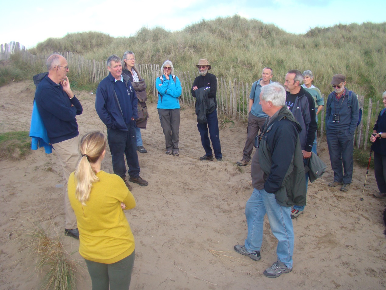
On Tuesday 25th October the AONB’s Project Officer led a Guided Walk around part of the Northam Burrows Country park site, in partnership with Torridge District Council’s Head Ranger Michael Day.
17 people turned up to learn about the historical importance of the site as well as its unique nature conservation value.
Dave explained how the 3 mile long pebble-ridge is a natural phenomenon that had been created as a result of erosion of cliffs to the west and by longshore drift of the debris within Bideford Bay. The ridge is a recent coastal landform being first recorded in the 1600’s and gradually extending towards the Taw Torridge Estuary in the 18 & 19th Centuries. Visitors also learned that Westward Ho! was a relatively recent settlement, being entirely created in the mid 19th century as a result of Charles Kingsley’s historical novel, set in the time of the Spanish Armada, called Westward Ho!
The resort is one of a number built on the Victorian’s desire to “take the salt waters” promoted for its benefits to health, which led in the 19th century to a rise in the popularity of holidays by the sea. Here in North Devon new settlements such as Westward Ho! and Woolaocmbe were entirely created whilst other established settlements, such as Ilfracombe and Clovelly moved from being working fishing ports and harbours to ones that offered a new tourism product, first to the wealthy Victorians but later to the rest of the population in the mid 20th Century when seaside holidays became popular with the working classes.
As well as the talking about coastal erosion and change, people learnt more about the remnant archaeology on site and the role that Northam Burrows and Westward Ho! Beach in particular played during the Second World War. Whilst the local Burrows landscape reveals archaeology associated with defence in the early 1940’s such as anti-glider obstacles and tank ditches and the old RAF Northam Radar Station, much of the area was used for practicing for the D Day invasions of1944, as the coastline closely resembled that of the Normandy coast where the landing actually took place.
The beach at Westward Ho! was used for amphibious trials and working out the logistics of getting invasion vehicles such as tanks and lorries ashore. Many of the so called Hobart Funnies (modified tanks that could overcome beach obstacles) were trialled here and in 1943 the Great Panjandrum was tested here. Built like a huge “Catherine wheel” and laden with explosives, the rocket powered Panjandrum was designed to roll up the beach and blow holes in sea defences! It was a much publicised although the current thinking is was that it was an elaborate hoax to convince the Germans that the Allies planned to invade the Pas De Calais and not the Normandy Coast.
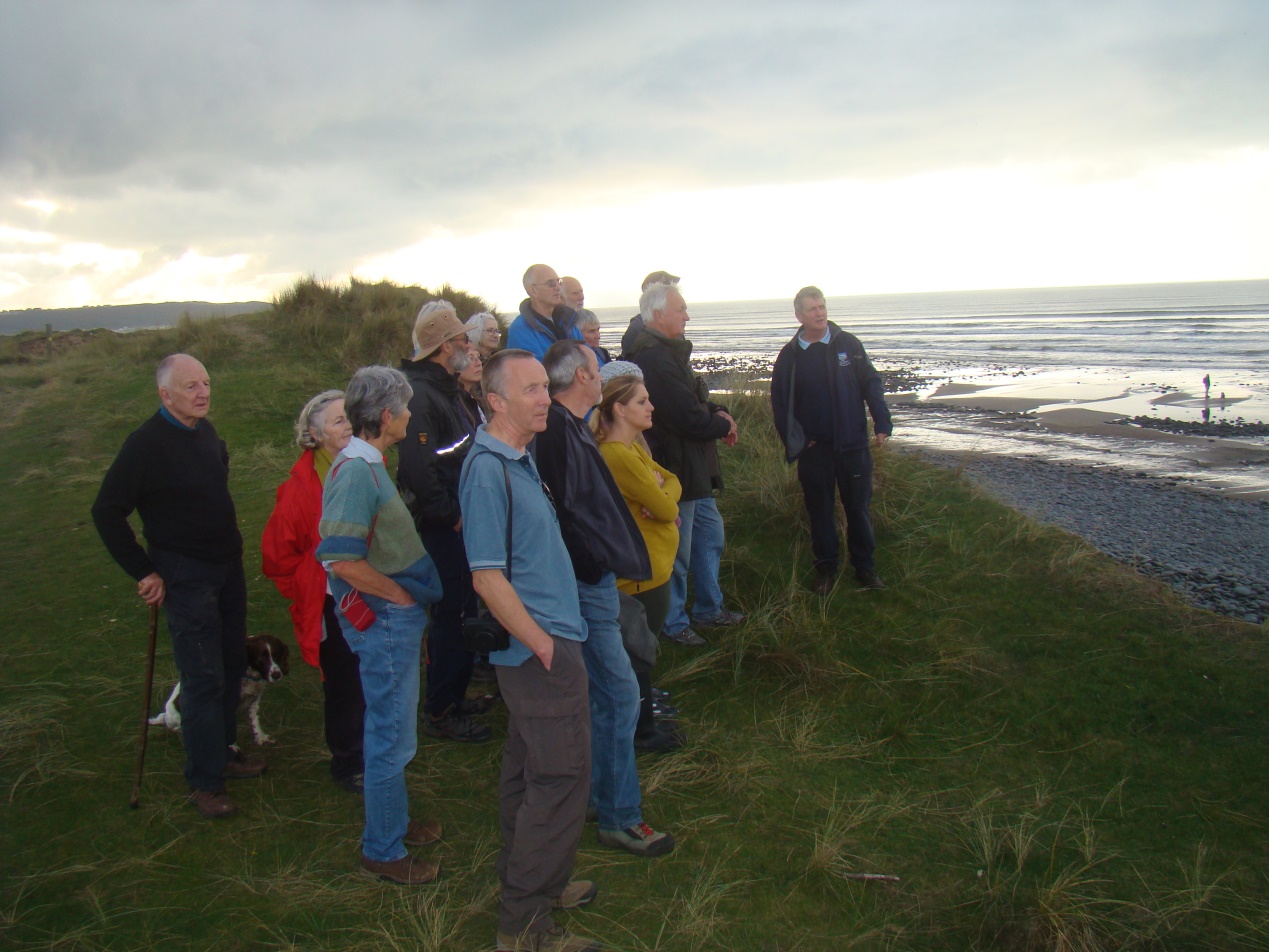
Later at the entrance to the estuary, people learned about the challenges of shipping entering estuary and the coastguard, lifeboat and lighthouse systems that were employed to assist mariners crossing of the infamous Bideford Bar sand bank to gain safe passage into a tidal estuary.
The walk concluded with Head Ranger Mike Day, explaining the nature conservation significance of the site and how the site was managed by landowners Torridge District Council with assistance from a government funded Environmental Stewardship Agreement.
This was an extremely successful event, made all the more interesting by being run in partnership between the two organisations and builds on the successful partnership established through the AONB’s Coastal Creatures Project. It is hoped that other events may be run in the near future, so look out for future events on our calendar.
Guided Walk and Volunteer Days on Northam Burrow this Autumn